

Nationally designated historic site Watanuki Guanyinshan ancient tomb 지도, 다마무라 초, 일본
사진
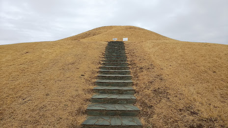
위치 Nationally designated historic site Watanuki Guanyinshan ancient tomb
Nationally designated historic site Watanuki Guanyinshan ancient tomb — 에 위치한 지역 명소 1752 Watanukimachi, Takasaki, Gunma 370-1207, Japan 그리고 카테고리에 속합니다 — historical landmark. 이 장소에 대한 평균 방문자 평점 — 4.1 (~에 따르면 232 등급, 오픈 소스 및 2022년 관련 정보).
정확한 위치 — Nationally designated historic site Watanuki Guanyinshan ancient tomb, 빨간색 마커로지도에 표시.
당신은 할 수 있습니다 길찾기 Nationally designated historic site Watanuki Guanyinshan ancient tomb 내 위치의 지도에서.
그 밖에 흥미로운 점 다마무라 초? 시티페이지에 가시면 모든 명소를 보실 수 있습니다.
좌표
Nationally designated historic site Watanuki Guanyinshan ancient tomb, 일본 십진수 형식의 좌표: 위도 — 36.30345486327129, 경도 — 139.12857742701448. 도, 분, 초로 변환 할 때 Nationally designated historic site Watanuki Guanyinshan ancient tomb 다음 좌표가 있습니다: 36°18′12.44 북위 과 139°7′42.88 동경.
가까운 도시
근처에 위치한 가장 큰 도시:
- 다카사키 시 — 10 킬로미터
- 마에바시 시 — 10 킬로미터
- 기류 시 — 22 킬로미터
- 구마가야 시 — 30 킬로미터
- 아시카가 시 — 30 킬로미터
- 가와고에 시 — 53 킬로미터
- 아게오 시 — 56 킬로미터
- 사야마 시 — 57 킬로미터
- 오야마 시 — 61 킬로미터
- 도코로자와 시 — 64 킬로미터
- 가스카베 시 — 68 킬로미터
- 사이타마 시 — 68 킬로미터
- 다치카와 시 — 70 킬로미터
- 아사카 시 — 71 킬로미터
- 고다이라 시 — 71 킬로미터
- 고쿠분지 시 — 73 킬로미터
- 하치오지 시 — 73 킬로미터
- 우쓰노미야 시 — 74 킬로미터
- 도다 시 — 74 킬로미터