

Nationally designated historic site Watanuki Guanyinshan ancient tomb 지도, 다카사키 시, 일본
코멘트
위치 Nationally designated historic site Watanuki Guanyinshan ancient tomb 지도, 다카사키 시, 일본. 십진수 형식의 지리 좌표와도, 분, 초. 이곳을 방문한 방문자의 사진, 주소 및 평균 평점.
사진
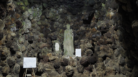
위치 Nationally designated historic site Watanuki Guanyinshan ancient tomb
Nationally designated historic site Watanuki Guanyinshan ancient tomb — 에 위치한 지역 명소 데이터 없음 그리고 카테고리에 속합니다 — -. 이 장소에 대한 평균 방문자 평점 — 4.0 (~에 따르면 308 등급, 오픈 소스 및 2022년 관련 정보).
정확한 위치 — Nationally designated historic site Watanuki Guanyinshan ancient tomb, 빨간색 마커로지도에 표시.
당신은 할 수 있습니다 길찾기 Nationally designated historic site Watanuki Guanyinshan ancient tomb 내 위치의 지도에서.
그 밖에 흥미로운 점 다카사키 시? 시티페이지에 가시면 모든 명소를 보실 수 있습니다.
좌표
Nationally designated historic site Watanuki Guanyinshan ancient tomb, 일본 십진수 형식의 좌표: 위도 — 36.30546107276256, 경도 — 138.98843562482546. 도, 분, 초로 변환 할 때 Nationally designated historic site Watanuki Guanyinshan ancient tomb 다음 좌표가 있습니다: 36°18′19.66 북위 과 138°59′18.37 동경.
가까운 도시
근처에 위치한 가장 큰 도시:
- 마에바시 시 — 9 킬로미터
- 기류 시 — 31 킬로미터
- 구마가야 시 — 39 킬로미터
- 아시카가 시 — 40 킬로미터
- 가와고에 시 — 62 킬로미터
- 사야마 시 — 64 킬로미터
- 아게오 시 — 65 킬로미터
- 우에다 시 — 68 킬로미터
- 오야마 시 — 71 킬로미터
- 도코로자와 시 — 71 킬로미터
- 다치카와 시 — 76 킬로미터
- 사이타마 시 — 77 킬로미터
- 가스카베 시 — 77 킬로미터
- 하치오지 시 — 78 킬로미터
- 고다이라 시 — 78 킬로미터
- 아사카 시 — 79 킬로미터
- 고쿠분지 시 — 79 킬로미터
- 나가노 시 — 80 킬로미터
- 고가네이 시 — 82 킬로미터