

Little Rock Central High School National Historic Site Visitor Center 지도, 리틀록, 미국
사진
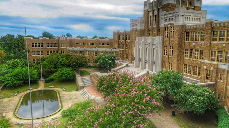
위치 Little Rock Central High School National Historic Site Visitor Center
Little Rock Central High School National Historic Site Visitor Center — 에 위치한 지역 명소 2120 W Daisy L Gatson Bates Dr, Little Rock, AR 72202, United States 그리고 카테고리에 속합니다 — visitor center. 이 장소에 대한 평균 방문자 평점 — 4.8 (~에 따르면 490 등급, 오픈 소스 및 2022년 관련 정보).
정확한 위치 — Little Rock Central High School National Historic Site Visitor Center, 빨간색 마커로지도에 표시.
당신은 할 수 있습니다 길찾기 Little Rock Central High School National Historic Site Visitor Center 내 위치의 지도에서.
그 밖에 흥미로운 점 리틀록? 시티페이지에 가시면 모든 명소를 보실 수 있습니다.
좌표
Little Rock Central High School National Historic Site Visitor Center, 미국 십진수 형식의 좌표: 위도 — 34.73798960574864, 경도 — -92.29752157521735. 도, 분, 초로 변환 할 때 Little Rock Central High School National Historic Site Visitor Center 다음 좌표가 있습니다: 34°44′16.76 북위 과 -92°17′51.08 동경.
가까운 도시
근처에 위치한 가장 큰 도시:
- 멤피스 — 207 킬로미터
- 슈리브포트 — 281 킬로미터
- 스프링 — 286 킬로미터
- 잭슨 — 335 킬로미터
- 털사 — 365 킬로미터
- 플라노 — 451 킬로미터
- 갈런드 — 452 킬로미터
- 프리스코 — 455 킬로미터
- 메스키테 — 457 킬로미터
- 리처드슨 — 457 킬로미터
- 세인트루이스 — 465 킬로미터
- 노르만 — 468 킬로미터
- 캐롤턴 — 469 킬로미터
- 댈러스 — 472 킬로미터
- 오클라호마시티 — 477 킬로미터
- 덴턴 — 479 킬로미터
- 클락스빌 — 480 킬로미터
- 어빙 — 483 킬로미터
- 배턴루지 — 487 킬로미터
수도까지의 거리
수도까지의 거리 (워싱턴) 에 관한 것입니다 — 1434 킬로미터.