
다른 위치
Pureo  비쿠냐
Aeropuerto General Bernardo O'Higgins
쿠라카우틴
Río Quenuir
카라우에
Boyecura
엘로아 현
Puerto Varas
Quilleco
비쿠냐
Aeropuerto General Bernardo O'Higgins
쿠라카우틴
Río Quenuir
카라우에
Boyecura
엘로아 현
Puerto Varas
Quilleco
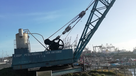
Grua 82 historica De San Antonio 지도, San Antonio, 칠레
코멘트
위치 Grua 82 historica De San Antonio 지도, San Antonio, 칠레. 십진수 형식의 지리 좌표와도, 분, 초. 이곳을 방문한 방문자의 사진, 주소 및 평균 평점.
사진
위치 Grua 82 historica De San Antonio
Grua 82 historica De San Antonio — 에 위치한 지역 명소 San Antonio, Valparaíso, Chile 그리고 카테고리에 속합니다 — heritage preservation. 이 장소에 대한 평균 방문자 평점 — 4.7 (~에 따르면 21 등급, 오픈 소스 및 2022년 관련 정보).
정확한 위치 — Grua 82 historica De San Antonio, 빨간색 마커로지도에 표시.
당신은 할 수 있습니다 길찾기 Grua 82 historica De San Antonio 내 위치의 지도에서.
그 밖에 흥미로운 점 San Antonio? 시티페이지에 가시면 모든 명소를 보실 수 있습니다.
좌표
Grua 82 historica De San Antonio, 칠레 십진수 형식의 좌표: 위도 — -33.58618054470723, 경도 — -71.613217192563. 도, 분, 초로 변환 할 때 Grua 82 historica De San Antonio 다음 좌표가 있습니다: -33°35′10.25 북위 과 -71°36′47.58 동경.
가까운 도시
근처에 위치한 가장 큰 도시:
- 발파라이소 — 59 킬로미터
- Quilpué — 61 킬로미터
- 비냐델마르 — 62 킬로미터
- Lo Prado — 84 킬로미터
- San Bernardo — 84 킬로미터
- La Pintana — 91 킬로미터
- Puente Alto — 96 킬로미터
- 랑카과 — 103 킬로미터
- 쿠리코 — 159 킬로미터
- 탈카 — 204 킬로미터
- 멘도사
 (아르헨티나) — 268 킬로미터
 - 산라파엘 (아르헨티나) — 319 킬로미터
- 치얀 — 337 킬로미터
- 산후안 (아르헨티나) — 370 킬로미터
- Talcahuano — 372 킬로미터
- 콘셉시온 — 380 킬로미터
- 코킴보 — 402 킬로미터
- 라세레나 — 408 킬로미터
- 로스앙헬레스 — 435 킬로미터
수도까지의 거리
수도까지의 거리 (산티아고) 에 관한 것입니다 — 91 킬로미터.