
다른 위치
Pureo  비쿠냐
Aeropuerto General Bernardo O'Higgins
쿠라카우틴
Río Quenuir
카라우에
Boyecura
엘로아 현
Puerto Varas
Quilleco
비쿠냐
Aeropuerto General Bernardo O'Higgins
쿠라카우틴
Río Quenuir
카라우에
Boyecura
엘로아 현
Puerto Varas
Quilleco
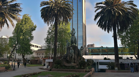
Plaza Anibal Pinto (Plaza De Armas Anibal Pinto) 지도, 테무코, 칠레
코멘트
위치 Plaza Anibal Pinto (Plaza De Armas Anibal Pinto) 지도, 테무코, 칠레. 십진수 형식의 지리 좌표와도, 분, 초. 이곳을 방문한 방문자의 사진, 주소 및 평균 평점.
사진
위치 Plaza Anibal Pinto (Plaza De Armas Anibal Pinto)
Plaza Anibal Pinto (Plaza De Armas Anibal Pinto) — 에 위치한 지역 명소 Claro Solar S/N, Temuco, Araucanía, Chile 그리고 카테고리에 속합니다 — plaza. 이 장소에 대한 평균 방문자 평점 — 4.4 (~에 따르면 5351 등급, 오픈 소스 및 2022년 관련 정보).
정확한 위치 — Plaza Anibal Pinto (Plaza De Armas Anibal Pinto), 빨간색 마커로지도에 표시.
당신은 할 수 있습니다 길찾기 Plaza Anibal Pinto (Plaza De Armas Anibal Pinto) 내 위치의 지도에서.
그 밖에 흥미로운 점 테무코? 시티페이지에 가시면 모든 명소를 보실 수 있습니다.
좌표
Plaza Anibal Pinto (Plaza De Armas Anibal Pinto), 칠레 십진수 형식의 좌표: 위도 — -38.74005865854293, 경도 — -72.59028609242007. 도, 분, 초로 변환 할 때 Plaza Anibal Pinto (Plaza De Armas Anibal Pinto) 다음 좌표가 있습니다: -38°44′24.21 북위 과 -72°35′25.03 동경.
가까운 도시
근처에 위치한 가장 큰 도시:
- 볼디비아 — 133 킬로미터
- 로스앙헬레스 — 141 킬로미터
- 오소르노 — 209 킬로미터
- 콘셉시온 — 216 킬로미터
- Talcahuano — 227 킬로미터
- 치얀 — 239 킬로미터
- 산카를로스데바릴로체
 (아르헨티나) — 286 킬로미터
 - 푸에르토몬트 — 304 킬로미터
- 탈카 — 375 킬로미터
- 네우껜 (아르헨티나) — 389 킬로미터
- 쿠리코 — 432 킬로미터
- 랑카과 — 532 킬로미터
- San Bernardo — 595 킬로미터
- Puente Alto — 595 킬로미터
- La Pintana — 597 킬로미터
- 산라파엘 (아르헨티나) — 597 킬로미터
- Lo Prado — 609 킬로미터
- 발파라이소 — 635 킬로미터
- Quilpué — 637 킬로미터
수도까지의 거리
수도까지의 거리 (산티아고) 에 관한 것입니다 — 615 킬로미터.